| Risultati della ricerca nelle immagini - "Cap" |

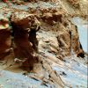
000-OPP-SOL1095-MF-LXT.jpgVictoria's Capes - Sol 1095 (Hi-Def3-D - credits and Copyright: Dr M. Faccin and Lunar Explorer Italia)100 visiteUna "Nuova Visione" di Marte, Made by Lunexit: si tratta di frames processati tridimensionalmente, ma adottando una tecnica ed un processing totalmente innovativi.
Confrontate queste "Visioni di Marte" con i 3D "Standard" NASA e...Vedrete la differenza, e CHE differenza!
Questa tecnica di elaborazione delle immagini (sviluppata da Marco Faccin e Gianluigi Barca, sotto Copyright Lunar Explorer Italia) è il primo passo verso la creazione di frames tridimensionali a colori (non più il "solito" blu/verde e rosso) e ad altissima definizione. Frames che permetteranno a chiunque li guardi (ed anche a persone che hanno problemi di vista) di mettere - letteralmente - gli occhi ed il naso "all'interno del paesaggio ripreso".
Ed ora (e per il momento), indossate gli "occhialini" e...in un istante Vi ritroverete DENTRO e AD UN PASSO dal margine e dai Promontori di Victoria Crater!
MareKromium
|
|

Chasmas-Capri_Chasma-PIA14952-PCF-LXTT.jpgFeatures of Capri Chasma: Mesas (Absolute Natural Colors; credits for the additional process. and color.: Dr Paolo C. Fienga - Lunexit Team) 187 visiteOrbit Number: 43357
Latitude: 14,01° South
Longitude: 309,42° East
Instrument: VIS
Captured: September, 23rd, 2011
Mars Local Time: 06:18 (Early Morning Hours)MareKromium
|
|

ESP_011345_0950_RED_abrowse.jpgSmall Fan-like Surface Features on the South Polar Perennial Cap (Natural Colors; credits: Lunar Explorer Italia)53 visiteMars Local Time: 17:54 (late afternoon)
Coord. (centered): 84,8° South Lat. and 339,3° East Long.
Spacecraft altitude: 247,7 Km (such as about 154,8 miles)
Original image scale range: 99,1 cm/pixel (with 1 x 1 binning) so objects ~ 2,97 mt across are resolved
Map projected scale: 1 mt/pixel
Map projection: EQUIRECTANGULAR
Emission Angle: 0,9°
Phase Angle: 88,7°
Solar Incidence Angle: 89° (meaning that the Sun is about 1° above the Local Horizon)
Solar Longitude: 181,0° (Northern Autumn)
Credits: NASA/JPL/University of Arizona
Additional process. and coloring: Lunar Explorer ItaliaMareKromium
|
|

ESP_014077_0930_RED_abrowse.jpgSouth Polar Residual Cap Monitoring (Natural Colors; credits: Lunexit)54 visitenessun commentoMareKromium
|
|

ESP_014114_0935_RED_abrowse.jpgSouth Polar Residual Cap Monitoring (Natural Colors; credits: Lunexit)54 visitenessun commentoMareKromium
|
|

ESP_014123_0930_RED_abrowse.jpgDry Ice (Natural Colors; credits: Lunexit)57 visitenessun commentoMareKromium
|
|

ESP_014181_0920_RED_abrowse.jpgThe South Polar Residual Cap (Natural Colors; credits: Lunexit)54 visitenessun commentoMareKromium
|
|

ESP_014261_0930_RED_abrowse.jpgSouth Polar Residual Cap Monitoring (Natural Colors; credits: Lunexit)56 visiteThis HiRISE image is of a portion of Mars' South Polar Residual Ice Cap. Like Earth, Mars has concentrations of water ice at both Poles.
Because Mars is so much colder, however, the seasonal ice that gets deposited at high latitudes in the Winter and is removed in the Spring (generally analogous to winter-time snow on Earth) is actually Carbon Dioxide Ice. Around the South Pole there are areas of this CO2 ice that do not disappear every Spring, but rather survive Winter after Winter. This persistent Carbon Dioxide Ice is called "South Polar Residual Cap", and is what we are looking at in this HiRISE image.
Relatively high-standing smooth material is broken up by semi-circular depressions and linear, branching troughs that make a pattern resembling those of your fingerprints. The high-standing areas are thicknesses of several meters of CO2 Ice.
The depressions and troughs are thought to be caused by the removal of Carbon Dioxide Ice by Sublimation (the change of a material from solid directly to gas). HiRISE is observing this CO2 Terrain to try to determine how these patterns develop and how fast the depressions and troughs grow.
While the South Polar Residual Cap as a whole is present every year, there are certainly changes taking place within it. With the high resolution of HiRISE, we intend to measure the amount of expansion of the depressions over multiple Mars years.
Knowing the amount of Carbon Dioxide removed can give us an idea of the atmospheric, weather, and climate conditions over the course of a year.
In addition, looking for where CO2 Ice might be being deposited on top of this terrain may help us understand if there is any net loss or accumulation of the CO2 Ice over time, which would be a good indicator of whether Mars' climate is in the process of changing, or not. (Written by: Patrick Russell)MareKromium
|
|

ESP_014342_0930-00.jpgSouth Polar Residual Cap Intraseasonal Change Monitoring (CTX Frame - Natural Colors; credits: Lunexit)54 visitenessun commentoMareKromium
|
|

ESP_014342_0930-02.jpgSouth Polar Residual Cap Intraseasonal Change Monitoring (EDM n.2 - Natural Colors; credits: Lunexit)54 visitenessun commentoMareKromium
|
|

ESP_014342_0930-03.jpgSouth Polar Residual Cap Intraseasonal Change Monitoring (EDM n.3 - Natural Colors; credits: Lunexit)54 visitenessun commentoMareKromium
|
|

ESP_014342_0930-04.jpgSouth Polar Residual Cap Intraseasonal Change Monitoring (EDM n.4 - Natural Colors; credits: Lunexit)54 visitenessun commentoMareKromium
|
|
| 88 immagini su 8 pagina(e) |
1 |
 |
 |
 |
 |
 |
|

